Located about 10 miles north of Boston, The Middlesex Fells Reservation is a public recreation area where you can hike, bike, cross-country ski, and kayak along the lands and waters. Covering more than 2,200 acres of forest, wetlands, and rugged hills in Malden, Medford, Melrose, Stoneham, and Winchester, Massachusetts, the large hilly wooded area offers views of the city skyline and surrounding neighborhoods along its 100 miles of trails.
January Report Hike Date: 2024/01/16 Hike Duration: 6:00 hours (1100-1700) Hike Direction: CCW Start Point: Red Cross Path Parking Lot Total Distance: ~8.00 miles (tracker failed) Weather Report: Rain and snow before 3pm, then rain likely between 3pm and 5pm, then a chance of rain, snow, and freezing rain after 5pm. High near 36. Northeast wind 6 to 9 mph becoming northwest in the afternoon. Chance of precipitation is 90%. New snow accumulation of 1 to 3 inches possible. Wildlife: None People: 12
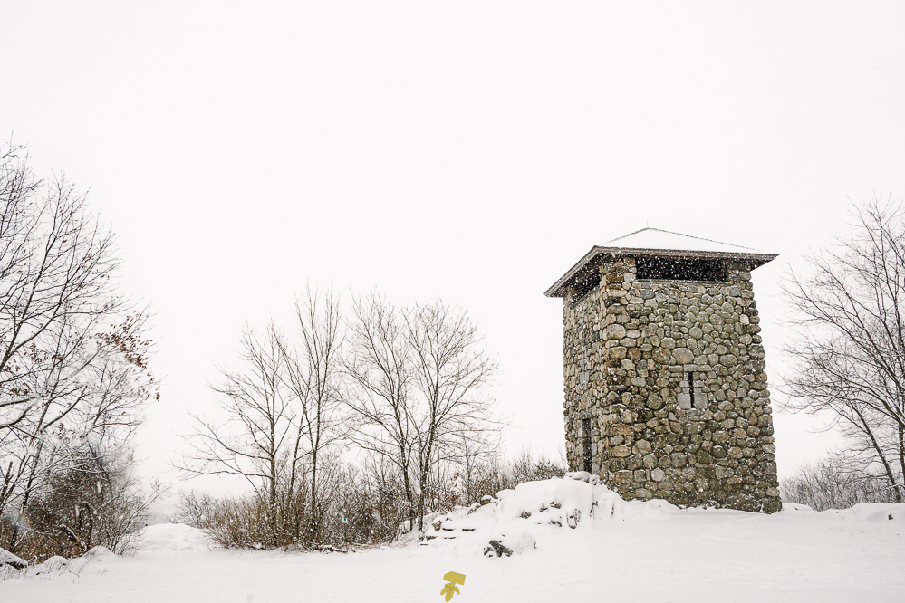
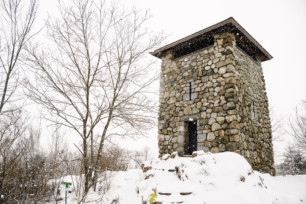
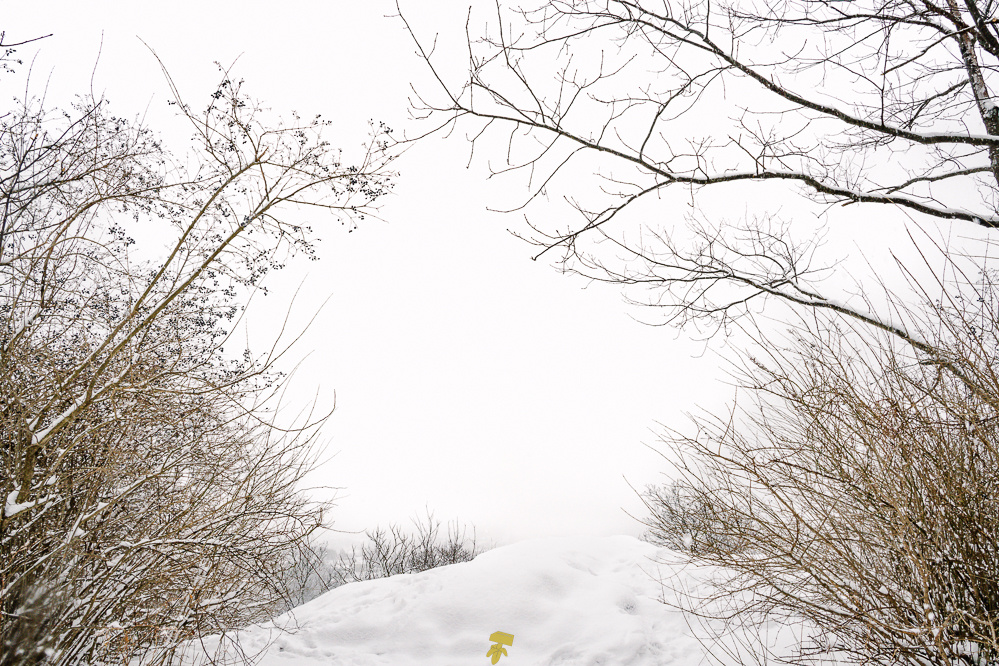
Beginning just west of Wright’s Tower along South Border Road, I took Red Cross Path and immediately arrived at Panther Cave. It’s just under a half mile to Wright’s Tower and I’m eager to catch the scene around the old fire watch tower and urban setting below. Only saw one person with their dog at the parking lot until reaching the tower where several people emerged, most with furry companions in tow.
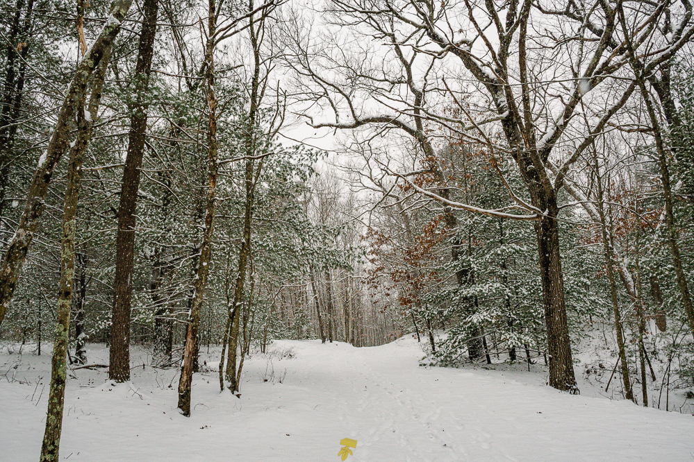
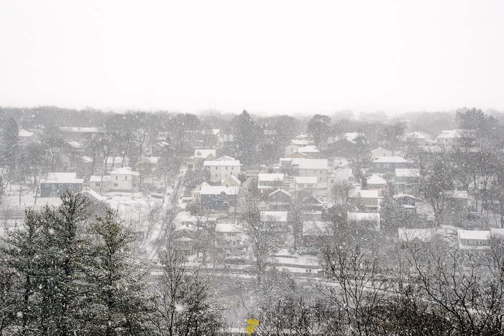
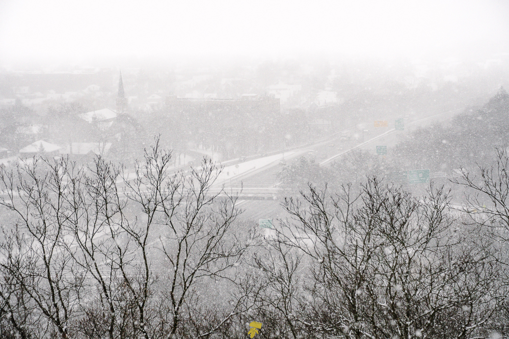
After enjoying a very snowy view from the outcrop past the tower that looks upon Medford and Interstate 93, I headed north, up and down the small rocky hills. Looks as if only one or two people have been on this section of the trail with faded footprints indicating they were here hours before me. With low visibility and snow gusting about, the footprints would appear as if a ghost were leading me, making subtle impressions in the white powder, guiding me along.
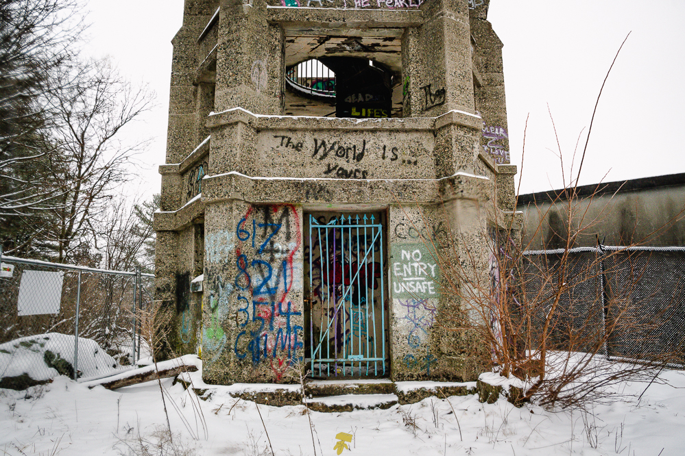
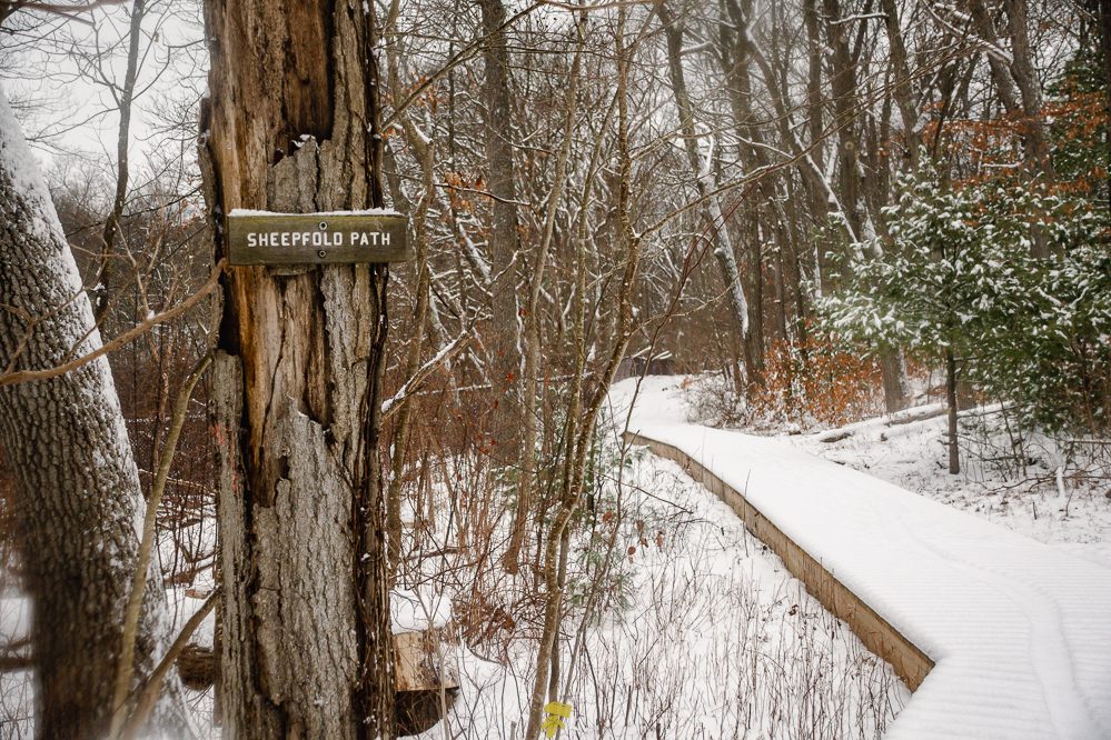
Not much happening at Sheepfold and the old soapbox derby track looks more like a ski resort bunny hill. Part of the Skyline parallels Railroad Trail, where I spotted a winter trail runner whom I startled when I blew my nose. I would encounter the runner again when taking a slight detour to check on the status and condition of Bear Hill Tower which has been labeled “unsafe” and has been fenced off to the public. As the tracks would prove, looked like the runner had been doing laps from Sheepfold to Bear Hill with several sets of tracks easily identified by the holes left by the spikes they were wearing.
By the time I reached the tower, the weather started to turn wet with the snow changing to sleet and then to rain by the time I came around the North Reservoir. It’s at this time I notice my outer later is not waterproof and has soaked through, as well, I realize I only have a couple of hours of sunlight remaining with a little less than half of the trail remaining.
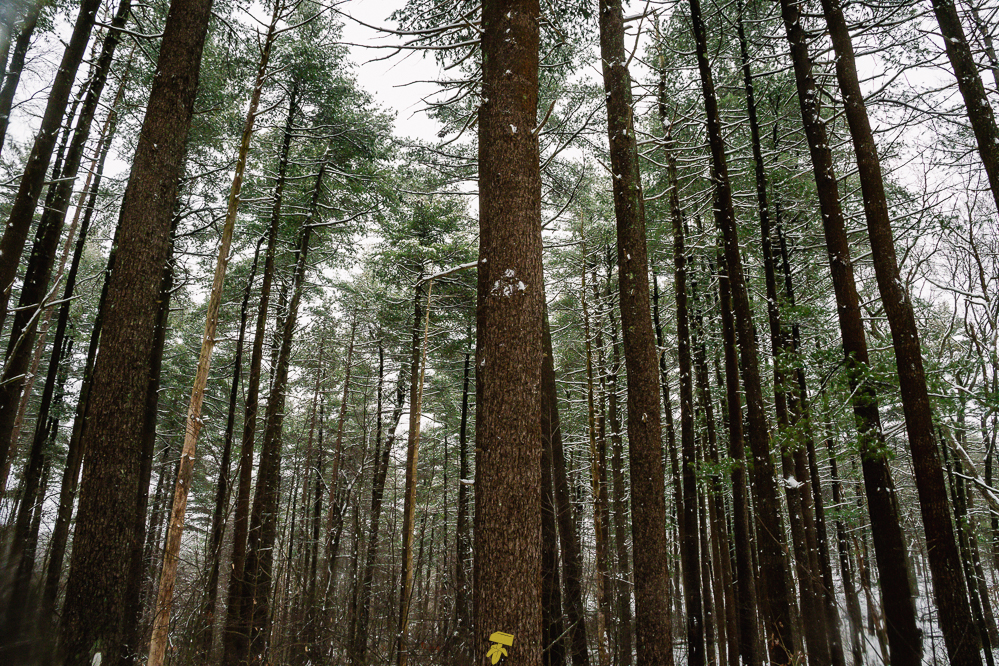
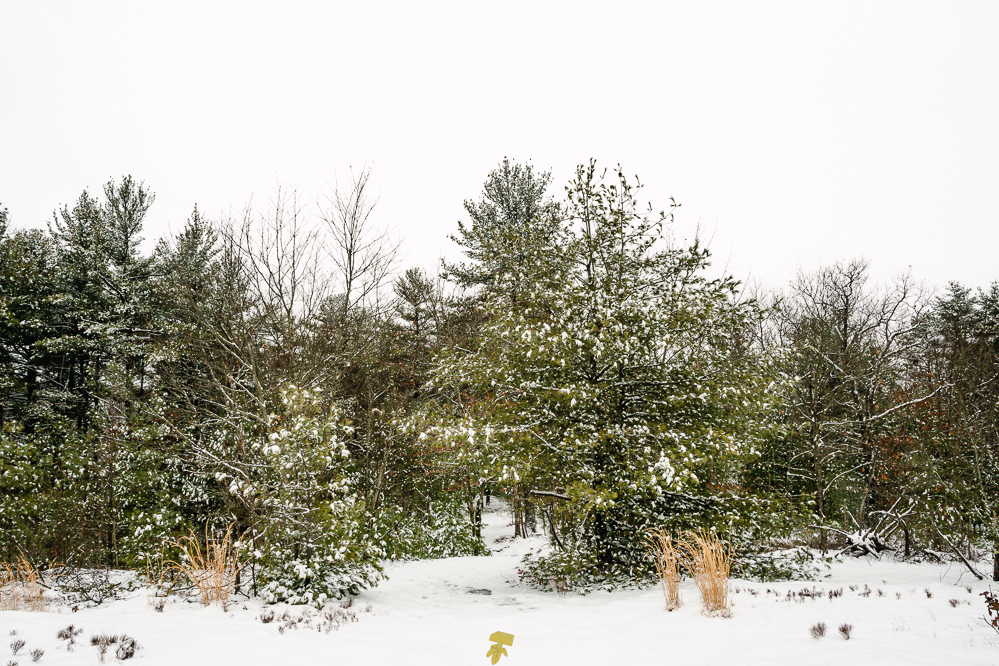
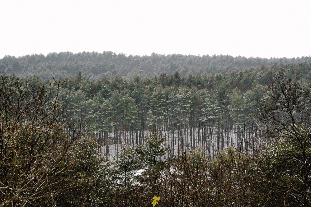
Now later in the afternoon, there are far more tracks on the path, both human and canine. The trails around the western edge of the reservation cut and weave through tall pines with a more open floor than the bushy sections of the deciduous side. It’s also more tranquil being further away from the highway, adding to the allure of this section.
I got to my car just as the final shimmer of light had faded into night. Everything but my snow pants failed to keep me dry, luckily by layering properly, I was able to stay warm and mostly comfortable as the snow and rain mixture slowly saturated me. Living nearby, I knew a beer and a hot shower would be had within a few moments, and didn’t worry too much about my feet being wet and clothing being compromised.
With the wetter weather, I ended up not taking many photos and opted to enjoy the hike and the exposure to winter conditions. It was good to test out some of my gear and find the threshold of protection of some of my waterproof and “water-resistant” apparel, pouches, and bags. It was an exhilarating hike and a fun start to this year-long documentary project.
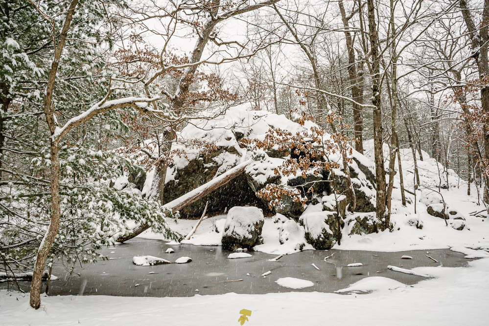
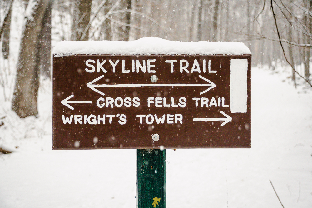
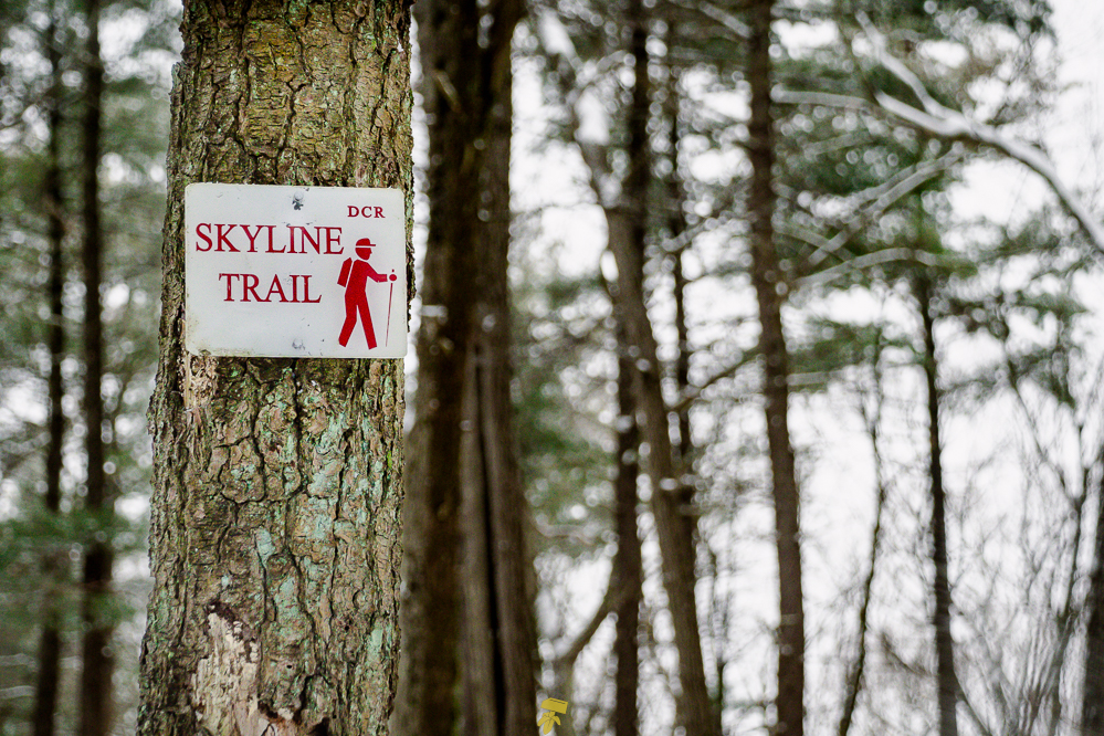
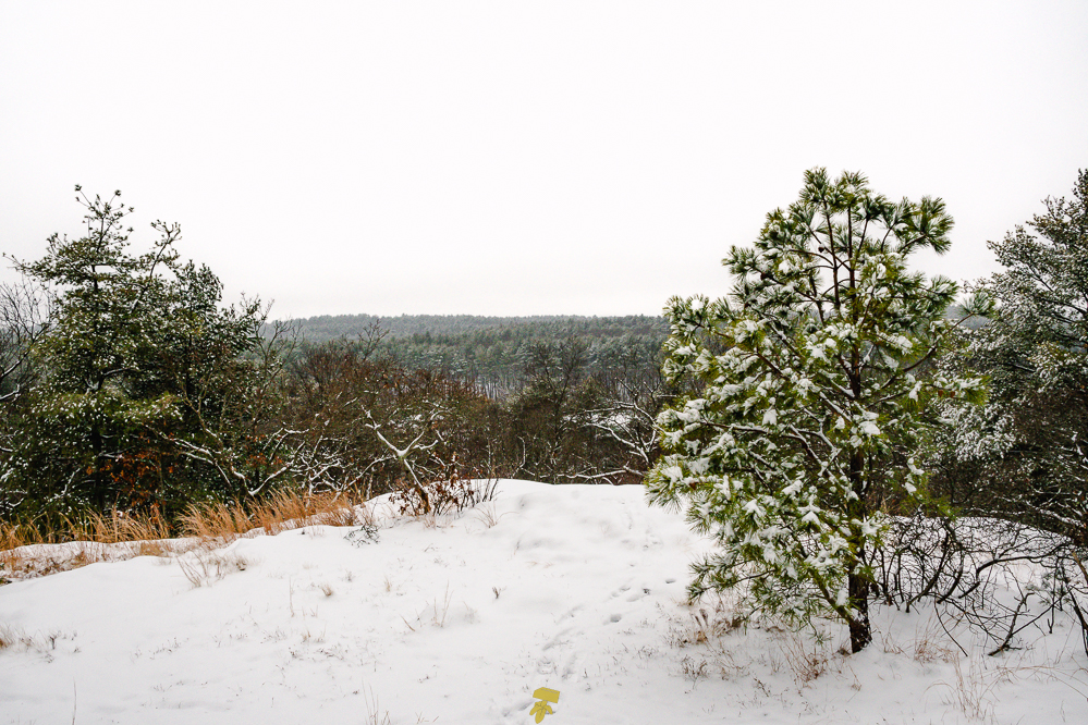
The Skyline Trail is a 7.5-mile trail located in the west section of the Middlesex Fells Reservation looping around the reservoirs and lower woods with Interstate 93 to the east. The path takes you by notable locations such as Panther Cave, Wright’s Tower, and an old soapbox derby track. The terrain is typical of Massachusetts with rocks scattered about and roots crisscrossing most of the trail.
The majority of the white-blazed path is wooded, with the west portion of the trail being more coniferous and the east boasting more deciduous trees. You will pass fields, vernal pools, wetlands, rocky outcrops, and ponds along with climbing several hills, some of which have rather steep ascents, that offer views of the Boston skyline and surrounding communities.
I’ll be hiking this loop every month as a means of exercise and to test out various gear, hopefully with different weather conditions, to better prepare myself for longer and more difficult hikes. I’ve also become more interested in being able to identify plants, trees, and birds and will be incorporating this into my hikes, especially to get to better know the woods that have always been my local stomping grounds. I hope to document the seasonal changes and the subtle differences from month to month as I traverse this moderately challenging route.
If you would like to support the park which aside from the DCR is maintained by community volunteers, The Friends of the Middlesex Fells Reservation’s mission is to promote the conservation, appreciation, and sustainable enjoyment of the Middlesex Fells Reservation. The Friends of the Middlesex Fells Reservation is a 501(c)(3) nonprofit organization and all contributions are tax-deductible. https://www.friendsofthefells.org/donate